Friday, February 3, 2023

A Preview of "Stars on Earth: Transpacific Navigation and Settlement of the Americas"

UPDATE March 13, 2024: The Berkeley City Council approved the purchase of the West Berkeley Shellmound from developers, with title transferred to the Ohlone land trust. It is now preserved for future generations. The two other sites remain threatened.


With Stephen D. Janes, PhD


Tomales Point/Point Reyes and the Farallon Islands, all on the coast of California, are presently threatened with substantial damage and destruction.


South Farallon Islands
Source: Common Murre Restoration Project, USFWS, public domain, via Wikimedia Commons

The Farallon Islands, above, an immense nature sanctuary for huge numbers of birds and mammals, face a 1.5 T rodenticide drop this year, sponsored by Point Blue and authorized by the California Coastal Commission and the U.S. Fish and Wildlife Service. A substantial bykill can not be effectively stopped, controlled, or mitigated. The toxins will spread through the area, into one of the richest fisheries off the San Francisco coast.

********

On the central coast of California, a megalithic archaeological site has been discovered. Structures composed of massive rocks weighing several tons occur as an unique assemblage on the Point Reyes Peninsula. 


Its features include a 258-meter stone line, standing stones, raised earthen platforms, a spring, and a roundhouse foundation. Rounded boulders perched on stone piles are arranged to map the stars of the constellation Cassiopeia in the night sky. Confirmation that the builders of these structures regularly visited and used the site came with the discovery of the roundhouse and platforms.


Cassiopeia, Tomales Point

 Source: Stephen D. Janes, Google Earth Pro


The presence of this star map and many other cosmological connections between the structures suggest that the site apparently was built for regular astronomical observation. The oral traditions of the contemporary Coast Miwok, Indigenous people there, confirm the area of the stone line was used as a path for the spirits of the dead. The roundhouse and platform mounds were used in ceremonies.


Based on these and other extensive observations and research, it was also discovered that this site is connected to other sites, that their entirety is an immense ceremonial complex, and that this area represents an early Polynesian settlement in the Americas.


Coast Miwok are related to their neighbors, the Ohlone, by language, culture, and DNA. The Ohlone have a related mortuary complex in San Francisco Bay. Their West Berkeley Shellmound has functioned for thousands of years as a funerary site and portal for the dead.


San Francisco Bay Area Geomorphic Theophanies 

Source: Lou-Anne Fauteck Makes-Marks, Google Earth Pro


These tribes also share geomorphic theophanies. Mythic characters from Coast Miwok and Ohlone traditional stories are mapped as and alive in the landscapes of the San Francisco Bay Area, including Coyote, his Flea/Shrimp wife, Hummingbird, Eagle/Condor, and Pelican. These theophanies are common in the Americas as well as other places in the world. (See related posts on this blogsite.)


Rock Line, Tomales Point

Source: Stephen D. Janes


The mortuary complexes include jumping-off places at Mt. St. Helena, Alcatraz Island, and Tomales Point for spirit travel over the ocean to the Farallon Islands, their Islands of the Dead.


Jumping-off places like these have only been located in Polynesia, where they were common, and along the coast of the Americas, including Southern California.


The Farallon Islands were respected as shelter for the spirits of the dead, a place where some spirits reincarnated as birds, a home for Coyote, and a stopping point on the spirits’ journey to join the ancients. Ancient remains may have been preserved there in its network of caves.


Community roundhouses were in use historically around the world and are still in use in Central California and South America. Megaliths were known globally, including elsewhere in California, Pacific Island cultures, and India. Features of Tomales Point and a Chumash site at Point Conception are comparable to early Polynesian ceremonial spaces.


Previous linguistic research with related Penutian languages indicates that initial coastal settlement in this area was early in time, with later population movement fanning out from the coast. In genetics, the same area is a proposed location for the founding mtDNA haplogroup B2 (B4b2), exclusively found in Indigenous American populations, but rarely in the Arctic. Haplogroup B4 is found across the Pacific and in Asia. This also supports early Pacific-route settlement along the coast fanning out into the Americas.


Previously unknown Australasian DNA traces have been found in multiple tests of Indigenous populations on the South American Pacific coast and Amazonian regions. Cranial morphological testing indicated comparable results.


Contemporary Coast Miwok lineal descendants show DNA traces of South Indian/Australasian/Polynesian DNA in preliminary testing. Cultural traits of Coast Miwok and Ohlone are similar to those of South India, Australasia, and Polynesia. 


The Tamil of South India are identified as being a related culture for Coast Miwok and Ohlone. Their mutual languages can be related to Dravidian and other agglutinative languages, likely derived from the Indus Valley. Cultural similarities are exhibited across a broad spectrum of related peoples in the Americas, Polynesia, Australasia, India, and Siberia.


Early navigation and trade by boat in the Indian and Pacific oceans were common, especially among South Indians, Australasians, and Polynesians. In the open ocean, navigation was by observation and by the stars.


There is a known star map for the Polynesian Triangle, together with a reverse star map of Cassiopeia, found in western Polynesia. Star maps are known elsewhere in the Americas as well. There is evidence that Polynesians also mapped the Pacific Coast of the Americas by the stars and intentionally settled mapped areas, as well as oral traditions in California that they visited. Early coastal settlements can be found at the locations of the stars on their star maps.


Polynesian Islands Cassiopeia

Source: Lou-Anne Fauteck Makes-Marks, Google Earth Pro


The Farallon Islands correspond to the location of the North Star on Polynesian star maps. These islands were once the only mountain peaks along this edge of the continent. As such, they are the most likely first landfall for early South Indian/Australasian/Polynesian settlers on the Central California Coast.


This evidenced South Indian/Australasian/Polynesian settlement was earlier than current archaeological dating allows. Contemporary research now confirms more generous dating of other early archaeological sites in the Americas than in the past. 


Multiple other researchers have presented research to support these conclusions.


These are sacred places, and they should be protected and preserved.


A book is now available online, Stars on Earth: Transpacific Navigation and Settlement of the Americas, by Lou-Anne Fauteck Makes-Marks, PhD, and Stephen D. Janes, PhD.


Learn What You Can Do


Point Reyes: 

https://www.sacredamerica.org/2021/11/spirit-paths-and-sacred-places-point.html

https://www.idausa.org/campaign/wild-animals-and-habitats/tule-elk/latest-news/media-release-actor-peter-coyote-speaks-out-for-tule-elk-of-point-reyes-national-seashore/

https://www.biologicaldiversity.org/campaigns/protecting_Point_Reyes_elk/index.html 

https://biologicaldiversity.org/w/news/press-releases/lawsuit-challenges-point-reyes-ranching-elk-killing-plan-2022-01-10/


Farallon Islands:

http://poisonfreesanctuary.org

https://actionnetwork.org/petitions/citizens-speak-stop-the-poison-drop-at-the-farallon-islands

https://www.idausa.org/campaign/wild-animals-and-habitats/latest-news/farallon-islands-mice-rodenticide/

https://www.defendthemall.org/blog/2022/8/19/species-spotlight-the-farallon-camel-cricket


West Berkeley Shellmound:

https://sogoreate-landtrust.org/2024/03/13/the-west-berkeley-shellmound-sacred-site-will-be-returned-to-the-lisjan-ohlone-through-sogorea-te-land-trust/


Saturday, February 26, 2022

Chaos on the Pacific Coast: Poison Drops and Crisis Capitalism in California


In the midst of California’s Greater Farallones National Marine Sanctuary, the Farallon Islands are also sanctuary for the largest bird population in the lower 48 states and central to immense populations of protected marine animals that feed there on its food-rich waters. Humans feed there, too, because many fishermen derive their—and our—livelihood there.

The Farallon Islands are a Native American sacred place, their islands of the dead. The California Coastal Commission ignored that argument in making their decision to allow the coming poison drop there. There is no evidence that they or the U. S. Fish and Wildlife Service consulted with any or all of the tribes that would be affected by a poisoned environment.

The islands and their waters are currently threatened with helicopter drops of 1.5 tons of Brodifacoum-laced pellets, a rodent poison banned in the rest of California, to kill a population of mice there (http://poisonfreesanctuary.org). 

The mice function as prey for avian predators and have established their own ecological niche. They are not proven to be nonnative or recent arrivals. They are Mus musculus, a species of mice native to Asia, that could have migrated to the Americas in the distant past, possibly along with early Polynesian peoples who settled there. 

The drop is promoted by the islands’ manager, Point Blue, supported by Island Conservation—both California coastal environmental organizations—and approved by the U.S. Fish and Wildlife Service (USFWS) and the California Coastal Commission. 

The poison will be dropped in the next year, two years on the outside, and will spread into the avian sanctuary and the ocean, with multiple animals, perhaps whole species, dying. Raptors who migrate there seasonally to feed will also be poisoned.

The poisoned will bleed to death, and their scavengers can and will, too. The bykill of the poison drop will be substantial and an epic hazardous materials disaster. There have been numerous other island poison drops with massive failures and bykills to date.

The Farallon Islands are regularly treated by the application of herbicides, including glyphosate, and have been for years.

These islands are considered to be sacred to California Indian tribes as their Islands of the Dead, part of coastal mortuary complexes with Point Reyes for the Coast Miwok and with the West Berkeley Shellmound for the Ohlone (http://www.sacredamerica.org/2018/04/dancing-on-edge-of-pacific.html; http://www.sacredamerica.org/2021/11/spirit-paths-and-sacred-places-point.html). The West Berkeley Shellmound and Point Reyes have recently sustained other threats as well.

Very soon, the Farallons will be islands of the dead. Again. Poisoned to death.

The wider environmental community and sanctuary statuses were other, bigger antidotes against the poison. However, local environmentalists have been compromised by major funding and misinformation. The marine sanctuaries along the coast will be next to be compromised.

Archaeological evidence of human habitation from these Pacific Coast sites and the Continental Shelf would increase the perception of traditional cultural heritage value of these places and could furnish more evidence and arguments against the poison drop. No one who is for the poison drop or more fossil-fuel extraction would want that to happen.

Submerged Indian traditional cultural places are deemed possible on the Continental Shelf, from before and during ocean-rise flooding, roughly from 18,000 years ago to 6,000 years ago, and would be “extremely significant” if discovered (https://farallones.noaa.gov/heritage/firstpeoples.html). 

Human habitation on the Continental Shelf in California is not only possible, but predictable. A site in southern California has been dated to 200,000 years ago, Santa Rosa Island has been dated to 37,000 years ago, and there are habitation sites in Mexico dated to be over 280,000 years old (https://tipdba.com/database/). 

There is a resistance in mainstream archaeology to admitting these dates are possible, as well as resistance to admitting this in the Department of the Interior (DOI) and in the energy industries.

The DOI’s National Park Service (NPS) published a series of papers in the 1980s and later on submerged archaeology sites off Point Reyes and the Farallons, primarily shipwrecks. They found stream channels worn into the bedrock under Drake’s Bay—a clue to human habitation, wrote wistfully about the possibility of finding human habitation sites, but apparently didn’t look much further (https://www.nps.gov/parkhistory/online_books/maritime/pore.pdf).

In 2013, the DOI Bureau of Ocean Energy Management (BOEM) published a report,”Inventory and Analysis of Coastal and Submerged Archaeological Site Occurrence on the Pacific Outer Continental Shelf” (https://espis.boem.gov/final%20reports/5357.pdf). Authors were ICF International, Southeastern Archaeological Research, both publicly traded corporations, and Davis Geoarchaeological Research: “The goal of this study is to assist BOEM in the identification and location of underwater and coastal cultural resources along the Pacific coast to enable them to consider what effects the installation of energy facilities on the [Pacific Outer Continental Shelf] may have on these resources (231).”

An unstated goal of this study was to diminish and dismiss Native Americans’ claims for underwater and coastal resources along the Pacific Coast.

This paper asserted, among other claims: there might be prehistoric underwater archaeology sites off the coast, more likely on the southern coast (67); there wouldn't be anything before 14,000 years ago because that was the earliest probable date (83); inhabitants were not likely to be PaleoIndians but Paleoarchaic [i.e., not Indian] because they didn’t leave behind enough of the “true PaleoIndian” arrowheads (37); there were only a few kinds of traditional cultural properties where an "uninhibited view of the ocean” (175-177) mattered, i.e., without drilling rigs; and Coast Miwoks weren’t around until 4,000 years ago anyway (89).

Like the poisoned birds on the Farallons, these arguments won’t fly. They are fraudulent claims, manufactured to suit the interests of the energy companies and eliminate Native American claims. The authors, BOEM, and DOI were rubber stamping energy development along the coast.

  • Their coastal analysis of likely human habitation sites does not hold water in terms of predictive accuracy, especially when predictability was admitted to be equivocal: “the site location predictive model suggests that the value (and the assumed potential for holding a site) of any given grid square increases proportional to latitude, in a southerly direction . . . Conversely, this fact can also be taken to suggest that sites are more likely to be concentrated in greater frequency within the highest predictive value alluvial buffers of modeled stream systems toward the northern end of the POCS study area” (67). 
  • Fourteen thousand years ago is not the limit of human habitation on the coast when other sites in California are dated from 37,000 years ago upwards to 200,000 years ago. (https://tipdba.com/database/)
  • PaleoIndian vs. PaleoArchaic was an attempt to prove that Indian aboriginal and legal claims to America don’t really matter, after remains of the Kennewick Man, found in 1996 and dated to 8,340–9,200 years ago, was promoted by some scientists to be Caucasian and here first. The Kennewick Man was later identified by DNA to be Native American and returned to his related tribe around 2015 (https://www.nature.com/articles/nature14625). 
  • The lack of an expected artifact—especially when the lack is self serving—does not prove the absence or presence of a people. 
  • An “uninhibited view” of the ocean or lack thereof is inappropriate in this context and certainly not the arbiter of what is sacred to Native American peoples. 
  • Neither are the authors’ subjective, self-serving, and non-Native judgments about the character and relative importance of their arbitrary categories of what matters. 
  • The 4,000-years-ago arrival of the Coast Miwok is an unproven and antiquated hypothesis (https://tipdba.com/database/).
  • “The majority of Native Americans [in California] receiving an outreach letter did not respond” to researchers’ requests for information about sites (162), that is, two tribes furnished information out of 124 contacted, making for completely inadequate tribal input.

One of the major energy developers along the Pacific Coast is Chevron. Since Chevron's main offices are located in San Ramon, California, their sphere of influence is larger in California, even though other fossil-fuel companies are involved in similar efforts.

The Packards of Hewlett Packard and the Packard Foundation, heavy environmental funders on the coast and elsewhere, have a direct "pipeline" to Chevron. David Packard served on the board of directors of Chevron Corp. from 1972 to 1985 (https://biography.yourdictionary.com/david-packard). He even had an oil tanker named for him—the David Packard, built in 1977, was operated for Chevon (https://en.wikipedia.org/wiki/David_Packard). So it is very likely that Packard wealth is at least partially due to, influenced by, and perhaps still invested in Chevron. Its current directors are major owners of stock, so this may have been true for David Packard as well.

Before he served on Chevron’s board, David Packard also served as Deputy Secretary of Defense from 1969 to 1971, in the Nixon administration. He managed the Pentagon. “Deputy Secretary Packard procured an unwritten agreement from Secretary Laird that he could manage the Pentagon” (https://history.defense.gov/DOD-History/Deputy-Secretaries-of-Defense/Article-View/Article/585238/david-packard/). Packard resigned in 1971 to return to Hewlett-Packard and to join Chevron leadership.  

Packard Foundation money has heavily funded Point Blue's operations, and Point Blue's management at the Farallon Islands is now questionable. It has control over underwater research and access there and surrounding areas, so much so that finding archaeological evidence of Native American habitation there would be discouraged, the evidence potentially destroyed.

Starting in 2020, Chevron has been decommissioning five of its drilling rigs on the Continental Shelf. It is an empty, public-relations gesture, as it has abandoned very many others (https://www.chevron.com/stories/west-coast-decommissioning-program). Chevron has 16,000 drilling rigs in operation in the State of California. There is apparently the possibility of conversion of some rigs to wind and wave energies, so Chevron may be biding its time until the initiation of Blue Carbon offset projects (see below) may make clean up and conversions not only possible, but profitable.

Chevron has recently failed in Australia by delivering only half of promised carbon sequestration over a five-year period (https://www.theguardian.com/environment/2021/jul/20/a-shocking-failure-chevron-criticised-for-missing-carbon-capture-target-at-wa-gas-project). The company has also failed to clean up its drilling sites in Australia (https://www.boilingcold.com.au/wa-onshore-and-coastal-oil-gas-clean-up-to-cost-billions/).

Big fossil fuels and their money have now polluted the California State government and Washington, D.C. and are poised for more poisons. The poison drop may become a wedge in opening up the marine sanctuaries to more profit from drilling, mining, and other resource extraction, including sand dredging.

Chevron has a reputation for its underhanded tactics, aggression, and dishonest dealings. Their public relations firm in California, Singer and Associates, is efficient in polishing the Chevron brand. Indigenous opposition worldwide, in particular, has pushed back and cost Chevron, and the company is now retaliating. Attorney Stephen Donziger was subject to private prosecution by Chevron’s law firm, Gibson Dunn, for Donziger's role in a $9.5 billion dollar court award to Indigenous peoples in Ecuador against Chevron for massive pollution (https://amazonwatch.org/news/2020/0615-chevron-is-a-champion-of-environmental-racism; https://www.thenation.com/article/environment/donziger-house-arrest-prison/). Gibson Dunn attorneys also filed a pro bono Indian Child Welfare Act case against a Navajo family in September 2021 (https://lakotalaw.org/news/2021-09-17/icwa-sovereignty). 

It is apparent that the law firm is deliberately punishing and threatening environmental activists, Indigenous people, their children, and their sovereignty. 

Native American Debra Ann Haaland, Laguna Pueblo, was appointed Secretary of the Department of the Interior this year, the same DOI whose BOEM commissioned the 2013 report to diminish Native American interests in coastal and offshore California. DOI also is home to USFWS, who approved the poison drop, and to NPS, manager of Point Reyes, which has been in the news recently about abusive management of elk herds and extended private ranching leases on public lands. Public relations needs were no doubt served by Haaland’s appointment.

The California Air Resources Board’s (CARB) mine methane capture carbon offset protocols were developed in 2014 with fossil-fuel industry input and tailored to industry demands. Subsequent offset projects were furnished by the fossil-fuel industry (http://www.ienearth.org/docs/California-Methane-Offsets-Briefing-%20IEN.pdf).

The suspicion now is that the fossil-fuel industries, particularly Chevron, are hoping that the Farallon Poison Drop is another disaster to profit from, more crisis capitalism.

Already able to profit that way, Chevron owns real estate statewide in California, in particular defunct oil fields, plus a housing subsidiary, Pacific Coast Homes, that has morphed the polluted fields into housing developments. The City of Fullerton recently purchased a parcel of oil-field land from Chevron and Pacific Coast Homes with more than ample state and federal funding: “The City has received $27.45 million in grant funds from agencies such as the California Wildlife Conservation Board, the U.S. Fish and Wildlife Service, and the State Coastal Conservancy. This is above the appraised price of the east side of West Coyote Hills of $18.040 million” (https://fullertonobserver.com/2021/11/23/city-to-own-nearly-half-of-coyote-hills-as-open-space/; https://www.coyotehills.org/about-west-coyote-hills/).

It’s obvious that big fossil-fuel companies in California want more, including offshore drilling and mining. Offshore drilling has proliferated in California (https://www.dailykos.com/stories/2022/1/11/2073926/-Critics-Say-Newsom-s-Proposed-2022-23-Budget-Falls-Short-on-Confronting-Fossil-Fuels). Chevron is also interested in sponsoring California carbon-offset projects.

The State of California is currently proposing the restoration of California's coastal and marine ecosystems to increase carbon sequestration under CARB’s new Blue Carbon offset protocol for their Cap-and-Trade program (https://resources.ca.gov/Initiatives/Expanding-Nature-Based-Solutions?utm_medium=email&utm_source=govdelivery).

There are still multiple issues about the effectiveness of Cap-and-Trade. Carbon offset projects have major, systemic problems that can’t effectively be fixed (https://no-redd.com/trading-on-thin-air-fictive-redd-carbon-chaos-in-the-worlds-forests/). The industry has been rife with fraud from its beginnings.

With the Blue Carbon proposals as part of California's proposed strategies for climate change, fossil-fuel companies in California also stand to make more money by supplying offsets to balance California pollution.

They also stand to need good public relations to buffer their images (https://indonesia.chevron.com/en/environment).

Chevron has already developed infrastructure in 2021 for carbon offset project development and environmental restoration, with San Jose-based Blue Planet (https://www.chevron.com/sustainability/environment; https://www.chevron.com/stories/chevron-invests-in-carbon-capture-and-utilization-startup).

Chevron is developing carbon offsets from whales and animal excrement: (https://pbs.twimg.com/media/FMPZzHIXoAMClGl.png).

They are also requesting incidental take from their drilling operations. This is one of their requests: (https://media.fisheries.noaa.gov/2021-07/Chevron_Green%20Canyon%20VSP_2021LOA_App_OPR1.pdf?null=).

The American Petroleum Institute, whose members include ExxonMobil, Chevron, and other oil companies, unexpectedly backed the federal price on carbon this past year (https://www.independent.co.uk/news/world/americas/in-shift-oil-industry-group-backs-federal-price-on-carbon-biden-deb-haaland-washington-chevron-interior-department-b1822569.html)

The fossil-fuel companies also could make more money by arguing that coastal drilling and mining on the Continental Shelf is essential, the sanctuaries not so much. Fossil-fuel money is already talking in California government and expanding its reach statewide and oceanwide.

It will be even easier to remove marine sanctuaries from some or all environmental protection if the public perception is that there is widespread toxicity/pollution/destruction already and the measure is deemed by authorities to be desperately needed—much like the current mouse population on the Farallons. If public perception trusts its authorities to do the right thing, so much the better for profiteering.

When marine environmental organizations are funded by fossil-fuel companies, it is far more likely that drilling will go unopposed and that no Indigenous archaeological sites will be found on the Continental Shelf. The fossil-fuel foxes are guarding the marine sanctuaries.

Some toxic dumps offshore in California have recently received more news coverage. There are a lot of decaying shipwrecks off the coast as well as radioactive and DDT waste. Brodifacoum will pile on more toxicity. Most people tend to look away if it's messy, and it is. The fossil-fuel industry’s offshore workers may wear hazmat suits, but they will keep working.

Chevron might take a similar approach to that permitted under the United Nation's REDD+’s corrupt offset programme, also like the doubled profit of CARB’s Mine Methane Capture Protocol—the fossil-fuel industry could initially devastate an area through resource extraction, toxicity, and environmental degradation, then get offsets and additional revenues for "capturing" methane for liquified natural gas for downstream use through other fossil-fuel companies.

Once the Blue Carbon offset protocol is implemented, the fossil-fuel companies would be compensated for improving environments they already degraded, all the while offsetting their own industrial emissions and celebrating their liberal emissions caps.

Currently, substantial underwater exploration, research, and testing on the central California Coast, also in marine sanctuaries there, is dominated and/or controlled by environmental organizations funded by Packard Foundation money, linked to Chevron. It is unlikely these environmental organizations will fight new fossil-fuel developments.

Point Blue, the organization that proposed the poison drop, wrote its own EIS, will administer the drop, and be paid by the federal government for the Farallons poison drop, has had massive funding from the Packard Foundation. 

The California Coastal Commission voted 5 to 3 to approve the poison drop in December 2021. It is unlikely that they will fight the poison drop.

Island Conservation in Santa Cruz has been involved in other poison drop events and is pushing the Farallon drop. David Packard’s daughter Susan Packard Orr is on their advisory council, and grandson Heath Packard is on staff. Island Conservation has received Packard Foundation funding (https://www.islandconservation.org/advisory-council-founding-members/; https://www.islandconservation.org/dvteam/heath-packard/).

The Monterey Bay Aquarium, where Nancy Packard Burnett was a co-founder, and another of David Packard’s daughters, Julie Packard, is executive director, has its own major research efforts and has had significant Packard Foundation funding (https://www.montereybayaquarium.org/newsroom/staff-bios/julie-packard).

The Monterey Bay Research Institute, operated by the Packard Foundation, was founded with foundation funds in 1987 and does marine research (https://www.mbari.org/wp-content/uploads/2021/08/2020_MBARI_Financials_AICPA_FINAL.pdf).

It’s not an accident that these organizations are now prominent at their diverse locations along the coast. They are extraordinarily well funded, connected, and supported. They are in position to support oil company entrees to profit from fossil-fuel extraction and carbon offset greenwashing to clean it up.

There are claims made about the Packard Foundation funding—it’s a huge fund, easily available, and given quickly. Many environmentalists, environmental organizations, and others are funded by it. This serves to convince individuals and organizations that have Packard funding to be sympathetic or at least neutral to ongoing environmental abuses by public and private monied interests if they want to stay in business.

Sunday, November 14, 2021

Spirit Paths and Sacred Places: Point Reyes, Tomales Point, Farallon Islands, and Mt. St. Helena, California


Kehoe Beach, Point Reyes, Wikimedia Commons, NPS Natural Resources--Debra Miller

Standing on the rugged cliffs at Point Reyes, California at sunset, you may catch the brief and legendary green flash of the sun as it sinks below the distant horizon. A line of sea foam laces away from the point across the top of the waters, illuminated in the sunset’s fire. A green light may slowly wrap itself around you there. 

The spirits of Miwok dead, Indigenous to these Northern California places, wait there for their shining path across the waters. They will leave the land at Point Reyes, fly out over the ocean toward Coyote’s home at the distant Farallon Islands. “The Miwok people believed that the dead walked into the afterlife along a path of light thrown by the moon onto water.”1

Coyote and the Miwok path of the dead

You are waiting there with them, standing on the left ear of Coyote. He is here, too. So is Hummingbird, who is whispering to you in the wind.

The Earth is sacred, and so are her places. These are very sacred places, Point Reyes and the Farallon Islands. And they are intimately connected with each other and to the Ohlone's West Berkeley Shellmound, also sacred.

Point Reyes has been a sacred place to the Coast Miwok for thousands of years. There are hundreds of Miwok sites there. Memories of the past are woven into the landscape.

Tomales Point at Point Reyes participates in an ancient mortuary complex and contains pathways for the spirits of the dead. It contains man-made mounds, megaliths, a celestial calendar, and a buried circle.2

It is also situated in an immense geomorphic theophany, the presence of great spirit beings in and as places there. Well-known and colossal examples of geomorphic theophany, spirit in and as place, would be Mother Earth and Turtle Island.

The left side of the body of Coyote, the Creator and Trickster God, extends, from his nose at the Golden Gate, north up the Pacific Coast to his tail's end, and then inland, to Lake County. Coyote’s forepaw rests at San Pablo Bay. His eye is Bolinas, his ear is Point Reyes. 

The Coast Miwok share Coyote’s presence and expanse with their neighboring cousins, the Ohlone of the San Francisco Bay Area, who also know Coyote lives here.3

The right side of Coyote is “off the coast where the sun sets,”4 at the Farallon Islands.

Both Miwok and Ohlone dead migrate to the Farallon Islands, their Islands of the Dead and Coyote’s home, where the sun goes down.

Miwok and Ohlone migration paths of the spirits of the dead. Source: Google Earth

The migration west was documented for the Coast Miwok and other tribes:

The view that the Coast Miwok-speaking deceased went west was also documented during the historic period. In 1814, Duran and Fortuny wrote: “[t]hey [Coast Miwok] relate that their departed relatives live in other lands or on the other side of the sea “ . . .  The widespread central California belief in the land of the dead being located toward the west, across the ocean, makes it probable the Tamal shared this belief, particularly because Point Reyes, the stepping-off place for the dead, was within their tribal territory.5

Hummingbird, a messenger who brought fire to the Miwoks,6 is also alive at Point Reyes, perhaps whispering in Coyote’s ear, too. Hummingbird Coast, kalupi-tamal, is the elongated Tomales Point,7 the beak of Hummingbird, where the paths of the dead and living cross.

The dead travel on a “cloud path”8 over land from Mt. St. Helena and elsewhere, to get to this destination; they travel on an úte-mugu, dead people’s road.9

The Miwok and Ohlone can learn the route of the úte-mugu before they die, be guided along the way, and/or have it mapped and managed for them, so they are not lost.

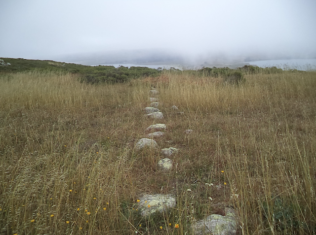
In many spiritual traditions, spirits are known to travel in a straight line, from point to point. Crossroads and other barriers can interrupt their paths.

Across the width of Tomales Point are two straight pathways of granitic stones, with a short distance between them. They are separated at the ridge line by the Tomales Point Trail, with the shorter line aimed to the northeast, to Mt. St. Helena, and the longer to the southwest, to the Farallon Islands. The angle of the shorter line diverges, estimated at 6 to 10 degrees, from the longer. The two lines total about 846 feet long. 

The Tomales Point Trail forms a crossroads at the rock lines, potentially interrupting the spirits’ path.

Granite rock lines are crossed by Tomales Point Trail. Source: Google Earth

While Wing et al. admitted, “An oral tradition says that it was built during prehistoric times by the Coast Miwok,” they concluded, “historical and circumstantial evidence associates it with nearby ranches.”10 

They argued for the rock-lines’ similarity to “New-England style stone wall construction”11 but admitted the line has "little resemblance to a New England-style stone wall.”12

They reported a claim by geologist Daniel Karner that the southwest extension of the longer rock line did not point to the Farallons, contrary to reports. However, Karner admitted, "It does point directly at Fanny Shoal and Noonday Rock, a shallow although invisible spot to the north of the Farallones.”13 In actuality, Fanny Shoal and Noonday Rock, part of Fanny Shoal, are considered part of the Farallons.14 These landmarks would also have been visible as peaks before the sea level rise between 12,000 to 7,000 years ago, not submerged.

Tomales Point rancher Mervin McDonald reported to Wing: 

“I was always told the Chinese people built that wall.” We asked if he meant 19th century laborers working for hire, and he affirmed that. He said he didn’t see what use the line could have been to an early rancher. He remarked that it was “a lot of work” to build it.15 

Wing et al. dismissed Miwok tradition as “not unambiguous,” and endorsed McDonald, a fifth-generation rancher with tenuous oral connections to much earlier, first-generation rancher Solomon Pierce, as contradictive:

The Miwok oral tradition is the main reason to believe the line is prehistoric, but this tradition is not unambiguous. It is also contradicted by Rancher Mervin McDonald’s oral tradition. Mr. McDonald took possession of the point only a little more than a century after Solomon Pierce did. McDonald is a fifth generation rancher. It is very likely he knew people whose grandparents had worked for Solomon Pierce.16

The Miwok oral tradition in this regard is much more substantial as evidence and should be considered.

The lines are older than most local American settlement. “The rock line is man-made and appears on an 1862 Coast Survey map.”17 It was noted to be on an 1854 survey map18 and acknowledged by historians that it “may have been constructed by ‘paleo-Indians.’”19 

Janes reported, “the stone metrics data set [from Wing, et als., 2015] reveals several features that do not suggest a wall or property line.”20

There is substantial evidence that this is a mortuary site. This site also includes man-made mounds, megaliths, a celestial calendar, and a buried circle. It is very improbable that ranchers and/or Chinese laborers working for them21 would have constructed these as well as the stone lines. These paths were built and cared for by ancestors of Coast Miwok and perhaps others. 

The rock paths function much like airport runways for the spirit world. It is plausible that the two lines were originally one, straight line, joined without an angle. 

The current 6-to-10-degree difference in angle of the more northeastern rock line on Tomales Point may reflect fault-line slippage. Tomales Point is on the western side of the San Andreas fault, on the Pacific Plate, which is slipping slowly northwest. The Farallons are also on the Pacific Plate, moving northwest at the same rate. Over a long period of time, that slippage could have changed the angle of a straight path from Mt. St. Helena through Tomales Point and Point Reyes to the Farallon Islands. In order to correct the path for the spirits, the eastern line could subsequently have been moved.

An initial estimate range of the time lapse involved in fault slippage requiring an angle adjustment is from 104,000 to 253,000 years. A measurement of the current angle of the shorter line being off the peak at Mt. St. Helena could reveal an estimated date that the angle was adjusted.

The northeastern path plots a straight line to Mt. St. Helena, a sacred place and a portal for the dead, from where the spirits of the dead can depart on their journey to the other world. The dead could be met on Mt. St. Helena, perhaps elsewhere, by dead relatives come to meet them. 

Miwok James Knight narrated stories about the journey to the Land of the Dead:

A brother grieves over the death of his sister, watches at her grave until she rises on the fourth night, and follows her to the top of Mount St. Helena, where her dead relatives greet her and accompany her to the Land of the Dead in the middle of the lake (or ocean). Her brother slips past the chief . . . but is forced to go back, following a brief visit. He returns . . . after stopping again on Mount St. Helena, becoming a powerful person.22

The western path on Tomales Point is aimed southwest toward the Spirit Jumping-Off Rock, where the dead are directed down into the ocean. The Spirit Jumping-Off Rock was described by medicine man Tom Smith: “A place of rock about 2 feet long marks the spot where the dead jump into the ocean. They go down there. There is a road back of the breakers.”23 

Sighting toward Point Reyes, the spirits follow a straight line behind the breaking surf along Point Reyes Beach. The road leads past lands end at Point Reyes, where a trail of milky foam then leads them to the Farallons. Thalman wrote, “the dead followed a line of foam from Point Reyes, out to the Creator.”24 

The path to the Land of the Dead can apparently be two way, with some spirits going and returning.

When a person dies his Wal'-le or Ghost goes to Hel'-wah the West, crossing the great ocean to Oo-tā-yo’-me, the Village of the Dead. In making this long journey it follows hinnan mooka, the path of the Wind. Sometimes Ghosts come back and dance in the roundhouse; sometimes people hear them dancing inside but never see them.25

The roundhouse referred to here could also refer to the buried stone circle at Tomales Point, below, likely constructed as a roundhouse.

The Coast Miwok present when Sir Francis Drake arrived in 1579 in what is now regarded as Drake's Bay at Point Reyes may have thought Drake and his company were returned dead and treated them ritually: 

Kroeber, Heizer, and others have suggested that the Tamal perceived the English as returned spirits or ghosts of dead ancestors . . . Kroeber wrote . . . "The simplest explanation is that the Indians regarded the whites as the returned dead."26  

Heizer also suggested this was partially due to the "Tamal association of Point Reyes with the realm of the dead."27

The rock lines are surrounded by an area with other stones and mounds, where there are celestial markers and constellar mapping. In particular, the pattern of the constellation known as Cassiopeia and its adjacent stars is a ground figure there, likely a topomorphic theophany.28 The ground figure of Cassiopeia has five stars in a M pattern, like the constellation. 

Ground figure of Cassiopeia. Source: MIAMO Archaeology, http://www.ancientlines.com/tomales-point/

Sky map of constellation Cassiopeia. Source: Wikimedia Commons

In geomorphic and topomorphic theophanies, ground figures on the earth are often direct or mirror images of the spirit beings in the night sky, copying the pattern of stars seen in the constellation or mirroring them. The difference between geomorphic and topomorphic is scale, whether it is land or place.

The coordination between earth and sky was believed among the Lakota Sioux to provide for a connection and an energetic exchange with the constellations.29 This is very likely true for the ground figure at Tomales Point.

Among the Kumeyaay, a California tribe, Cassiopeia is seen as a racer snake, llykuushirra.30 This may hint at its representation among the Coast Miwok, where it also leans toward being an obsidian blade.

Obsidian was sourced at Mt. St. Helena by the Coast Miwok and other tribes. 

The mountain has five peaks arranged in an M pattern.31 The M pattern of the five peaks also is patterned like the constellation Cassiopeia.


A topographic map of Mt. St. Helena, with red circles at peaks. Source: https://www.peakbagger.com/peak.aspx?pid=1182

The mountain was known as chitch’-ahpiɁs, evidently “obsidian-blade mountain,"32 and also as omótok lúpu, "big rock."33 

There is a Coast Miwok legend that Coyote arranged the killing of Mt. St. Helena through the killing of Obsidian Old Man, by Coyote’s grandsons, the Elk brothers.34 Ironically, the tule elk walk Tomales Point and the ground figure there now.

There are also indications that the Coast Miwok were separated from traditional territories—now in Napa County—in the past,35 and thus also separated from Mt. St. Helena. The “death” of the mountain in their cosmology may have recorded historical events where the Miwok moved away and surrendered access. 

Many cosmologies around the world regard the constellation of Cassiopeia as a female, a mother goddess from whose breasts the "milk" of the Milky Way appears to flow. Schedar, one of its stars, means "breast" in Arabic.36 

The Milky Way is a known path of the dead in many Native American cultures.37 

Cassiopeia is a circumpolar constellation, visible in most of the Northern Hemisphere year round,38 so it would have been visible on a clear night at Tomales Point.

At lands end at Point Reyes, with the moonlight on the foam and the Milky Way overhead, the path is clear. The dead have an ocean of stars beneath their feet and an ocean of stars above them.

There is a buried circle at the site, 30 feet in diameter, that appears to be quarried out about three feet into the bedrock, per Stephen Janes.39 It is likely a roundhouse; it is surrounded by scattered rocks that may have been supporting wall for a roof.

The megalith that Janes has named Goliath stands nine feet tall and sits on a foundation of supporting stones over a chamber beneath it. The stone’s deeply incised surface contains a petroglyph, a star formation, that capitalizes on natural fissues in the rock. The petroglyph on Goliath faces west, toward the land of the dead and the spirit world, like similar petroglyphs observed on territory of the Klamath tribe.40

The design of the petroglyph is in the style of the axis mundi found in shamanic cultures. The axis mundi represents the center of the world, a representation of the known universe around this one point, encoding the infinity of space. The axis mundi pattern has also been observed among the Chumash, a coastal tribe in California with a similar mortuary complex on the Pacific coast.41

The mortuary site at Tomales Point may have also included a grotto with an eternal fire. The Ashochimi/Wappo, a neighboring tribe to the east, related their traditions about Point Reyes as well: 

    In case of death the body is immediately incinerated, and the ashes flung into the air. They believe that the spirit is thus borne aloft and flies away to a grotto hard by the sea at Punta de los Reyes. In this grotto is a fire which burns without ceasing, and which no living being may behold without being instantly stricken blind. The disembodied spirit enters, hovers over and around this fire for a season, then flutters forth again and wings its flight over the ocean to the Happy Western Land.42 

There are grottoes at Point Reyes. The San Andreas fault line has methane/gas vents along it that could have been lit as an eternal flame within them. It was perhaps concentrated enough to precipitate blindness, as liquified methane gas can cause blindness. (https://www.ccohs.ca/oshanswers/chemicals/chem_profiles/methane.html).

It is apparent that Tomales Point was a stopover for the dead en route to the west and that ceremonies took place there.

This place may also have something to do with the story about how Hummingbird stole fire, since Tomales Point is known to be Hummingbird’s beak. Tom Smith said, “Hummingbird went up the coast from Tomales to fetch fire. He got it right there where his breast is red";43 “kulupi [hummingbird] wanted it on his throat so that everybody would see it as he flew around. They made this fire at San Lucas.”44 

San Lucas was the home of Coyote: “San Lucas, over here in Tomales, was old Coyote’s first rancheria."45  Coyote “lived at San Lucas. Wore a feather jacket; no shoes.”46 “Had a big sweathouse or dance house of his own down there.”47

I have found comparable complexes with similar details among the Chumash Indians in California, the Klamath Basin Indians, the Blackfoot/Blackfeet in Montana and Canada, and places elsewhere in North America. They are a culturally important phenomenon. These mortuary complexes are ancient traditional cultural places and sacred to Indigenous peoples.


There is well-established presence of human habitation in North and South America before 11,200 years ago. Paulette Steeves listed 111 archaeological sites in North America that are older than 11,200 years and 58 in South America.48 


The 4th and 5th oldest sites on Dr. Steeves’ North American list are the Cerutti site and Calico sites in Southern California, with evidence of human activity, that date back to minimally 130,700 years and 200,000 +/- 20,000 years respectively.49 There was extensive testing to establish those dates. It is likely that more northern locations along the coast were also suitable for habitation during this extended time period. The complex at Point Reyes may be a part of those early habitation patterns in California.


The Pacific Ocean level rose and flooded the Continental Shelf, where the Farallones are situated, between 18,000 to 6,000 years ago.50 Even a conservative research estimate admits that Indigenous humans could have been in North America, along the Pacific Coast, at least 20,000 years ago,51 well before the ocean level rose. That means that during that period of time, large areas of the Continental Shelf were above water, the Farallones were more accessible, and coastal habitation was probable there, as coastal peoples stay close to ocean food sources. Evidence of habitation thus may still exist and be found there.


So it is plausible that the Point Reyes/Farallon Islands complex stands among the most ancient traditional cultural places in North America that have been identified to date, and that megalithic remains could continue to be found at the Farallones and on the Continental Shelf.

Like the Ohlone West Berkeley/Farallon Islands mortuary complex, the details of the Point Reyes/Farallon Islands mortuary complex hold great depths of traditional knowledge and understanding of their world.

They must be protected for future generations.

Point Reyes and the Farallon Islands are presently threatened with damage and destruction. 

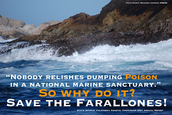
The Farallons are facing a proposal by the U.S. Fish and Wildlife Service for a 1.5 ton poison drop to kill rodents that can cause irreparable harm to marine sanctuary areas, affecting fish, birds, and other wildlife. Many more California tribes, beyond the Ohlone and Coast Miwok, will be affected by the proposed poison drop at the Farallon Islands as the rodenticide will migrate into food chains up and down the coast.

Point Reyes is facing continued archaeological site degradation and environmental damage from commercial grazing leases. The restored tule elk population there are facing at least partial extermination. The National Park Service did not follow through on their  2008 nomination of an Indigenous Archaeological District there to the National Register of Historic Places. Instead, in 2013, they nominated the Drakes Bay Historic and Archaeological District, which was approved. In 2015, they withdrew the Indigenous Archaeological District and replaced it with an Historic Dairy Ranching District, also approved.

The West Berkeley Shellmound was declared a historic landmark by the City of Berkeley in 2000. In 2020, the National Trust for Historic Preservation had nominated the site as one of the most endangered historic places in the U.S. on their annual list. On March 13, 2024, title to the West Berkeley Shellmound was transferred to the Ohlone land trust, so it is no longer threatened.

Consultation with tribes is required at the state and federal levels with the government agencies involved, including U.S. Fish and Wildlife Service, National Park Service, and the California Coastal Commission. It should take place with all tribes impacted by their actions.

Our Mother Earth is incalculably old. These sacred American places are thousands upon thousands of years old, peers to places like Stonehenge, reminders of ancient Amaruka. They are all worthy of respect and preservation.


Ritual costume, Kukshuy, California Coast. Kunstkamera, Russia.


Endnotes

1. Greg Sarris, in Brennan 2015, 205-214.
2. MIAMO Archaeology.
3. http://www.sacredamerica.org/2018/04/dancing-on-edge-of-pacific.html
4. Tom Smith, in Collier and Thalman 2003, 432-433.
5. Russell 2011, 53.
6. Kelly 1978, 30-31.
7. Merriam 1920.
8. Maria Copa, in Collier and Thalman 2003, 450. 
9. Tom Smith, in Collier and Thalman 2003, 453.
10. Wing, Iida, and Wearing 2015.
11. Ibid.
12. Ibid., 4.
13. Ibid., 8.
14. https://en.wikipedia.org/wiki/Farallon_Islands
15. Wing et al., 9.
16. Ibid., 22.
17. DeRooy and Livingston 2008, 12.
18. Kimmey 2014.
19. Janes, citing Gardner 2007.
20. Janes, citing Wing et al. 2015.
21. Wing et al. 2015
22. Callaghan and Knight 2000, 335.
23. Tom Smith, in Collier and Thalman 2003, 450.
24. Thalman 2006.
25. Merriam 1910, 217, in Russell 2011, 53.
26. Russell 2011, 59-60.
27. Heizer 1947, 263, 271, 277, cited in Russell 2011, 60. 
28. Janes, n.d.
29. Goodman 1992, 17.
30. Richard Pettinger Heller, “Kumeyaay Star Lore,” citing J. P. Harrington. https://richard-pettinger-heller.org/2016/08/03/kumeyaay-star-lore/
31. https://en.wikipedia.org/wiki/Mount_Saint_Helena
32. Collier and Thalman 2003, 6.
33. Kelly 1978, 32.
34. Ibid., 32-33
35. Johnson 2006.
36. https://en.wikipedia.org/wiki/Alpha_Cassiopeiae
37. Gibbon 1972, 237.
39. Personal communication, 2021.
40. See David 2012, 62, citing Spier 1930, 102, in a discussion about Klamath rock art: “The west-facing tendency of the rock art suggests that its creation was related to the land of the dead, since it was located in the west.” The Klamath language has been grouped with Miwok in the Penutian language family, so they may share similar cultural beliefs as well.
41. Anderson 1993, 39.
42. Powers 1877, 200.
43. Collier and Thalman 2003, 423.
44. Ibid., 435.
45. Ibid., 12.
46. Ibid., 325.
47. Ibid.
48. Steeves 2021.
49. Ibid., 200. 

Find out more: 

http://www.sacredamerica.org/2018/04/dancing-on-edge-of-pacific.html
https://shellmound.org
http://poisonfreesanctuary.org


References

Anderson, John M. 1993. A Circle Within the Abyss. Center for Indigenous Arts and Cultures Press, n.p.i.

Brennan, Summer. 2015. The Oyster War: The True Story of a Small Farm, Big Politics, and the Future of Wilderness in America. Berkeley, California: Counterpoint. 

Callaghan, Catherine, introduction, and James Knight, narrator. “The Dead People’s Home.” In Luthin, Herbert W., ed. 2000. Surviving through the Days: Translations of Native California Stories and Songs. Berkeley, California: University of California Press. Accessed June 19, 2021. http://ark.cdlib.org/ark:/13030/kt1r29q2ct/

Collier, Mary E. T., and Sylvia B. Thalman, comps. and eds. 2003. Interviews with Tom Smith & Maria Copa: Isabel Kelly’s Ethnographic Notes on the Coast Miwok Indians of Marin and Southern Sonoma Counties, California. San Rafael, California: Miwok Archeological Preserve of Marin.

David, Robert James. 2012. The Landscape of Klamath Basin Rock Art. Ph.D. Diss. University of California, Berkeley.

DeRooy, Carola, and Dewey Livingston. 2008. Images of America, Point Reyes Peninsula: Olema, Point Reyes Station, and Inverness. Charleston, South Carolina: Arcadia Publishing.

Gardner, Gavin. 2007. "A Cultural Resources Study of the Spirit Jumping Off Rocks Site, Point Reyes National Seashore California." Rohnert Park, California: Anthropological Studies Center, Sonoma State University.

Gibbon, William B. "Asiatic Parallels in North American Star Lore: Milky Way, Pleiades, Orion." The Journal of American Folklore 85, no. 337 (1972): 236-47. Accessed June 26, 2021. https://www.jstor.org/stable/539498

Goodman, Ronald. 1992. Lakota Star Knowledge: Studies in Lakota Stellar Theology. Mission, South Dakota: Sinte Gleska University.

Heizer, Robert F. "Francis Drake and the California Indians, 1579." University of California Publications in American Archaeology and Ethnology 42, no. 3 (1947): 251-302.

Janes, Stephen D. “A New Hypothesis for the Origin and Function of the Stone Lines Known as the Spirit Jumping-Off Rocks, Tomales Point, Marin County, California.” MIAMO Archaeology. Accessed June 19, 2021. http://www.ancientlines.com/tomales-point/

Johnson, John R. 2006. “On the Ethnolinguistic Identity of the Napa Tribe: The Implications of Chief Constancio Occaye’s Narratives as Recorded by Lorenzo G. Yates.” Journal of California and Great Basin Anthropology 26, no. 2: 193-204: 2. Accessed June 23, 2021. https://escholarship.org/uc/item/3k52g07t

Kelly, Isabel. 1978. “Some Coast Miwok Tales.” The Journal of California Anthropology 5, no. 1: 21-41. Accessed June 21, 2021. http://www.jstor.org/stable/25748366

Kimmey, Samantha. 2014. “Mystery Rocks Draw Scholarly Investigation.” Point Reyes Light. July 24. Accessed June 21, 2021. https://www.ptreyeslight.com/article/mystery-rocks-draw-scholarly-investigation

Merriam, C. Hart. 1920. “Indian Names in the Tamalpais Region,” Mill Valley Record, 21, no. 52: 1. 28 February. Accessed June 24, 2021. https://cdnc.ucr.edu/?a=d&d=MVR19200228.2.36.4&e=-------en--20--1--txt-txIN--------1

MIAMO Archaeology. “Tomales Mounds a Message from Alpha Centari.” Accessed June 24, 2021. http://www.ancientlines.com/tomales-point/

Powers, Stephen. 1877. Tribes of California. In Contributions to North American Ethnology, Vol. III. Washington, DC: Government Printing Office.

Russell, Matthew Alan. 2011. Encounters at tamál-húye: An Archaeology of Intercultural Engagement in Sixteenth-Century Northern California. Ph.D. diss., University of California, Berkeley.  https://digitalassets.lib.berkeley.edu/etd/ucb/text/Russell_berkeley_0028E_11555.pdf

Steeves, Paulette F. C. 2021.The Indigenous Paleolithic of the Western Hemisphere. Lincoln, Nebraska: University of Nebraska Press.

Thalman, Sylvia B. 2006. “The Marshall Coast Miwok Cemetery.” Rancho Bodega Historical Society. Bodega Bay, California. Accessed June 19, 2021. http://www.ranchobodega.org/Miwok_Cemetery.pdf

Wing, Michael R., Kate Iida, and Emily Wearing. 2015. “Stone-by-Stone Metrics Shed New Light on a Unique Stone Alignment at the Point Reyes National Seashore, Marin County, Alta California.” Accessed June 19, 2021. California Archaeology 7, no. 2, 245-264. https://www.tandfonline.com/doi/full/10.1080/1947461X.2015.1108565